


Jeju Olle Trail: Which Course to Walk and What to Know Before You Go
Jeju Island’s JEJU OLLE TRAIL (제주 올레길) is a long-distance walking network that circles much of the island through coastal paths, volcanic landscapes, forests, and small villages.
In This Article
Jeju Island’s JEJU OLLE TRAIL (제주 올레길) is a long-distance walking network that circles much of the island through coastal paths, volcanic landscapes, forests, and small villages. The routes collectively cover hundreds of kilometers and have become one of Korea’s best-known walking experiences. You do not need to walk the entire network to enjoy it. Choosing a single course that matches your schedule and energy level is enough.
What the Olle Trail Actually Is
The word OLLE (올레) comes from a traditional Jeju dialect term referring to the narrow path connecting a house to the main road. The Jeju Olle Trail expanded this local idea into a connected system of walking routes beginning in 2007, eventually forming a network that stretches around much of the island.
Each course is marked by blue and orange ribbons tied to poles, trees, and stone walls along the route. The ribbons themselves function as the trail’s navigation system, making the courses relatively easy to follow even for first-time visitors. While most routes are accessible to casual walkers, some sections include moderate elevation around OREUM (오름) volcanic hills.
The Jeju Olle Foundation also issues an OLLE PASSPORT (올레 여권), which can be stamped at designated checkpoints along each course. Walkers who complete multiple routes often treat it as a personal travel record rather than a formal hiking challenge.
Course 1: The Classic Start
Course 1 runs along the eastern side of Jeju near Seongsan and is often considered the classic introduction to the Olle Trail system. The route passes coastal roads, quiet fishing villages, farmland, and stretches near SEONGSAN ILCHULBONG (성산일출봉), the UNESCO-listed volcanic tuff cone that has become one of Jeju’s defining landmarks.
The course is among the most popular on the island, especially on weekends and during peak travel seasons. For visitors with limited time who want a representative Jeju Olle experience without demanding hiking terrain, Course 1 is often the easiest recommendation.
Course 7: Jeju’s Southern Coastline
Course 7 follows part of Jeju’s southern coastline near Seogwipo and is widely regarded as one of the most scenic sections of the entire trail network. The route passes lava rock shoreline, sea cliffs, coastal forests, and the dramatic OEDOLGAE (외돌개) rock formation rising from the water offshore.
Compared to the northern coast, southern Jeju generally experiences milder weather and calmer winds, making this course a reliable option in most seasons. The appeal is less about reaching the endpoint than about gradually moving along Jeju’s volcanic coastline while the scenery changes from harbor towns to cliffs and open sea.
The Jeju Olle Traveler Center is also located in the Seogwipo area, providing route information, passport stamps, and facilities for walkers exploring nearby courses.
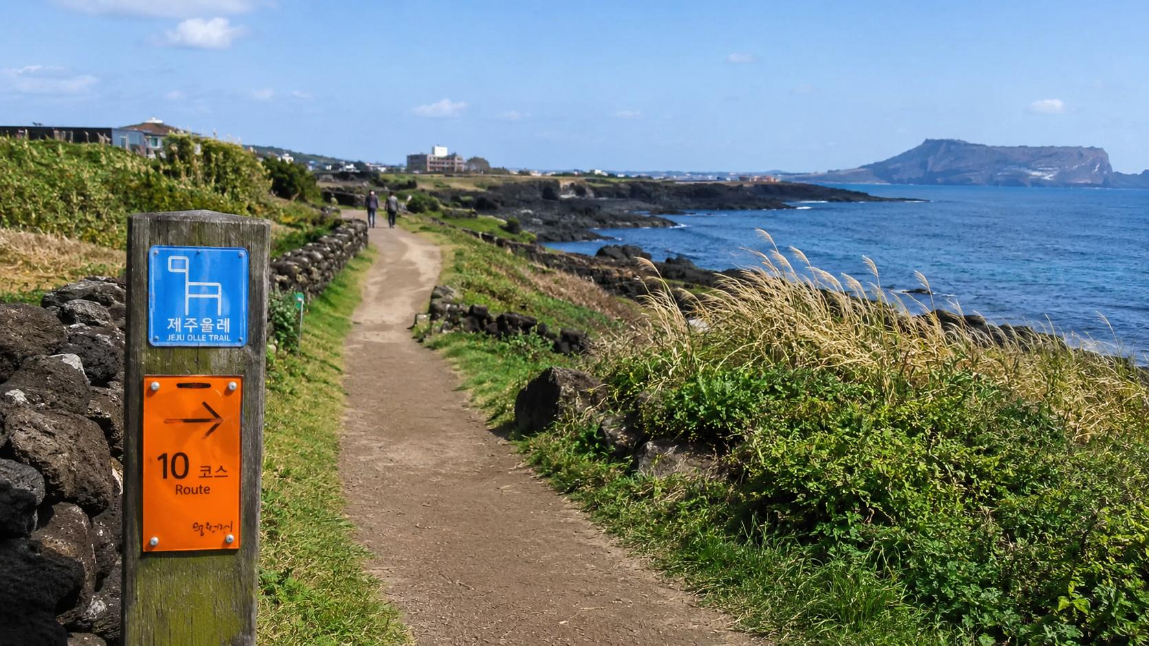
Course 10: Quiet Cliffs and Sea
Course 10 runs along Jeju’s southwestern coastline and is noticeably quieter than some of the island’s better-known Olle routes. The course passes black lava shoreline, small fishing harbors, sea-facing cliffs, and open coastal walking paths with fewer crowds than the eastern sections of the island.
One of the highlights is the area near SONGAKSAN (송악산), where the trail briefly climbs a volcanic ridge overlooking the southern sea and nearby islands including Marado and Gapado. For visitors looking for a slower and less crowded walking experience, Course 10 is often one of the best choices.
Course 14-1: Forest Over Coast
Most Olle courses stay close to the sea, but Course 14-1 takes a different approach by moving inland through forests, oreum grasslands, and traditional stone-walled villages in Jeju’s interior. The route offers a noticeably different atmosphere from the coastal courses, focusing more on woodland scenery and rural landscapes.
Parts of the course pass through forested areas near Hallasan, and the terrain can feel more physically demanding than the flatter coastal routes. Spring and autumn generally provide the best walking conditions, when temperatures are mild and the forests are at their most comfortable for long-distance walking.
Practical Information
Because each course begins and ends at different points, transportation planning is important. Public buses connect many trailheads, though rural routes may run less frequently than city buses. Renting a car provides the most flexibility, while taxis are generally available near major course endpoints.
Accommodation ranges from small guesthouses and pensions to larger hotels in Jeju City and Seogwipo. Travelers planning to walk multiple courses often choose separate bases in the northern and southern parts of the island instead of changing accommodation every night.
The Jeju Olle Trail can be walked year-round, though spring and autumn typically offer the best conditions. Summer brings humidity and occasional typhoon weather, while winter remains relatively mild but windy along exposed coastal sections.
The official Jeju Olle website provides route maps, current trail conditions, and passport information in both Korean and English. Trail maps and stamp information are also available at the Jeju Olle Traveler Center in Seogwipo.